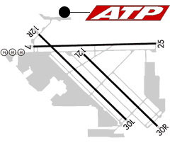
Click airport diagram for an FAA Flight Crew Briefing for KVGT
| FAA Identifier: | VGT |
| Lat/Long: | 36-12-38.5000N / 115-11-40.0000W 36-12.641667N / 115-11.666667W 36.2106944 / -115.1944444 (estimated) |
| Elevation: | 2205 ft. / 672.1 m (surveyed) |
| Variation: | 14E (1995) |
| From city: | 3 miles NW of LAS VEGAS, NV |
| Time zone: | UTC -8 (UTC -7 during Daylight Saving Time) |
| Zip code: | 89032 |
Airport Operations
| Airport use: | Open to the public |
| Activation date: | 01/1942 |
| Sectional chart: | LAS VEGAS |
| Control tower: | yes |
| ARTCC: | LOS ANGELES CENTER |
| FSS: | RENO FLIGHT SERVICE STATION |
| NOTAMs facility: | VGT (NOTAM-D service available) |
| Attendance: | 0600-2230 |
| Pattern altitude: | 3005 ft. MSL |
| Wind indicator: | lighted |
| Segmented circle: | yes |
| Lights: | WHEN ATCT CLSD ACTVT MIRL RY 07/25, RY 12L/30R AND TWY LGTS – CTAF. |
| Beacon: | white-green (lighted land airport) Operates sunset to sunrise. |
| Fire and rescue: | ARFF index A |
| Airline operations: | ARFF INDEX A, 139.315 (E) |
Airport Communications
| CTAF: | 125.7 |
| UNICOM: | 122.95 |
| ATIS: | 118.05 |
| WX ASOS: | 118.05 (702-648-6633) |
| NORTH LAS VEGAS GROUND: | 121.7 [0600-2000 OCT-MAR; 0600-2100 APR-SEP] |
| NORTH LAS VEGAS TOWER: | 125.7 360.75 [0600-2000 OCT-MAR; 0600-2100 APR-SEP] |
| APPROACH: | 119.4 RY 30 |
| DEPARTURE: | 119.4 RY 12 119.4 RY 30 |
| CLEARANCE DELIVERY: | 124.0 |
| RY 12 APCH/P: | 118.125 |
| WX ASOS at LAS (8 nm S): | PHONE 702-736-1416 |
| WX AWOS-3PT at HND (15 nm S): | 120.775 (702-614-4537) |
- RY 12 APCH PRVDD BY NELLIS APCH CTL ON FREQS 118.125/291.725.
- RY 12 DEP PRVDD BY LAS VEGAS TRACON (MC CARRAN) ON FREQS 119.4/282.2.
- RY 30 APCH/DEP PRVDD BY LAS VEGAS TRACON (MC CARRAN) ON FREQS 119.4/282.2.
- (APCH/DEP CTL TYPE) SEE TOWER REMARKS.
Nearby radio navigation aids
| VOR radial/distance | VOR name | Freq | Var | |||
|---|---|---|---|---|---|---|
| LASr333/8.0 | LAS VEGAS VORTAC | 116.90 | 15E | |||
| BLDr294/20.6 | BOULDER CITY VORTAC | 116.70 | 15E |
Airport Services
| Fuel available: | 100LL JET-A |
| Parking: | tiedowns |
| Airframe service: | MAJOR |
| Powerplant service: | MAJOR |
| Bulk oxygen: | HIGH |